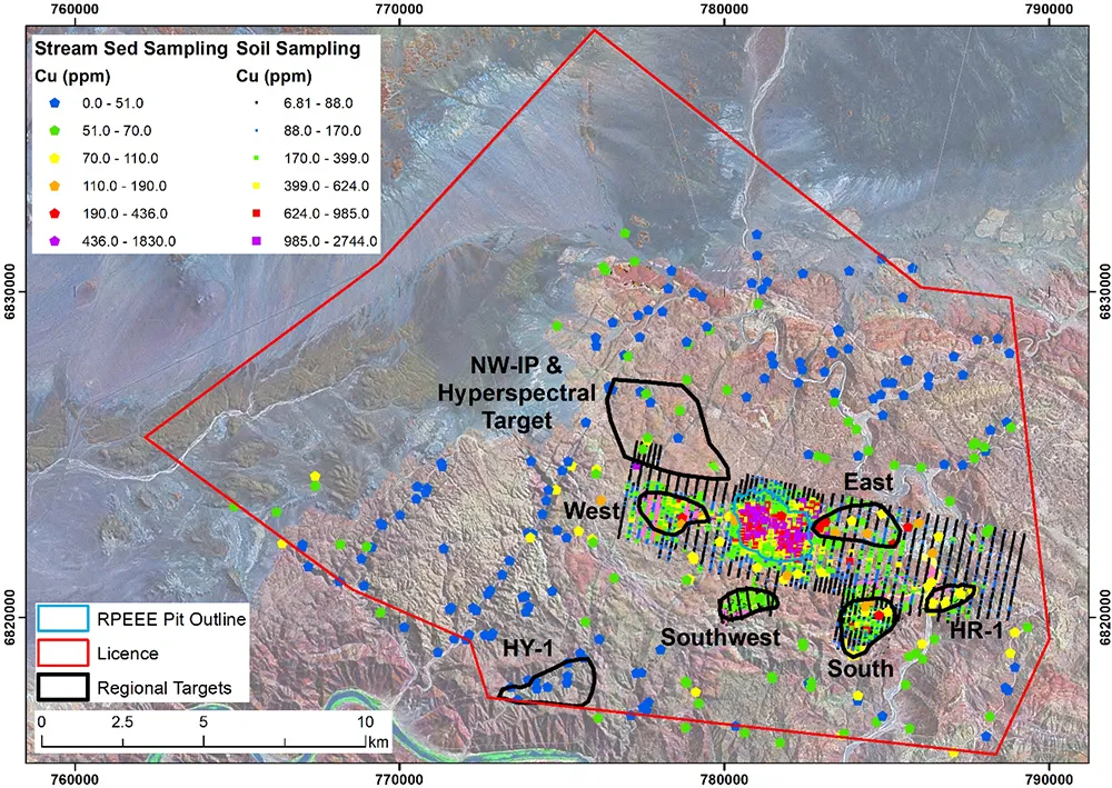
Previous work, by Teck in particular, highlighted several regional targets that had limited work carried out on them. Regional targets were identified based on satellite imagery interpretation and mapping (e.g. targets West, East, South, HR-1 and Southwest), hyperspectral colour anomalies (HY-1) and IP data (NW-IP and Hyperspectral target), as shown in this map. Limited follow up has been carried out on the targets immediately adjacent to Haib, with some drilling at South (4 drillholes), West (4) and East (12). In all cases the work performed was not sufficient to fully test the targets.
Koryx plans a regional program which will run in parallel to the PFS work at Haib during 2026, and will focus on mapping, selective sampling, ground geophysics and drilling. Available regional geophysical data is of moderate quality and an airborne magnetic survey is planned.